The interlinked public water system has abstraction boreholes at Westbury (the Wellhead), Upton Scudamore and Warminster. The source protection zones for Westbury Wellhead and part of Upton Scudamore are here:
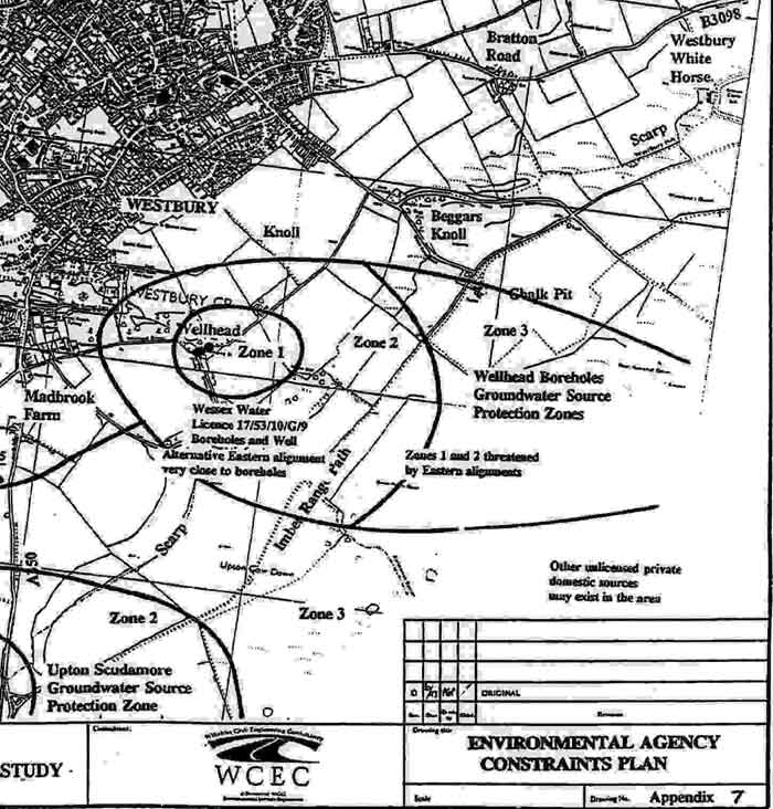
1997 WCC diagram showing threatened water source protection zones
In 1993, Wiltshire County Council had a main road constructed over the Upton Scudamore groundwater zone. It is in the area of
the lower left side of this map. This new section of the A350 is on a high embankment.
No particular
precautions were taken against the risk of water pollution. An accident is waiting to happen.
An embanked main road over the Westbury Wellhead water source also could have doubled the overall risk.
Wiltshire (County) Council is the local highway authority and, simultaneously, also the local planning authority. It has been acting as though it was a developer, with our overall environment rather down its list of priorities.
There are no large reservoirs in this area. Our water supplies rely on the sources under the escarpment.